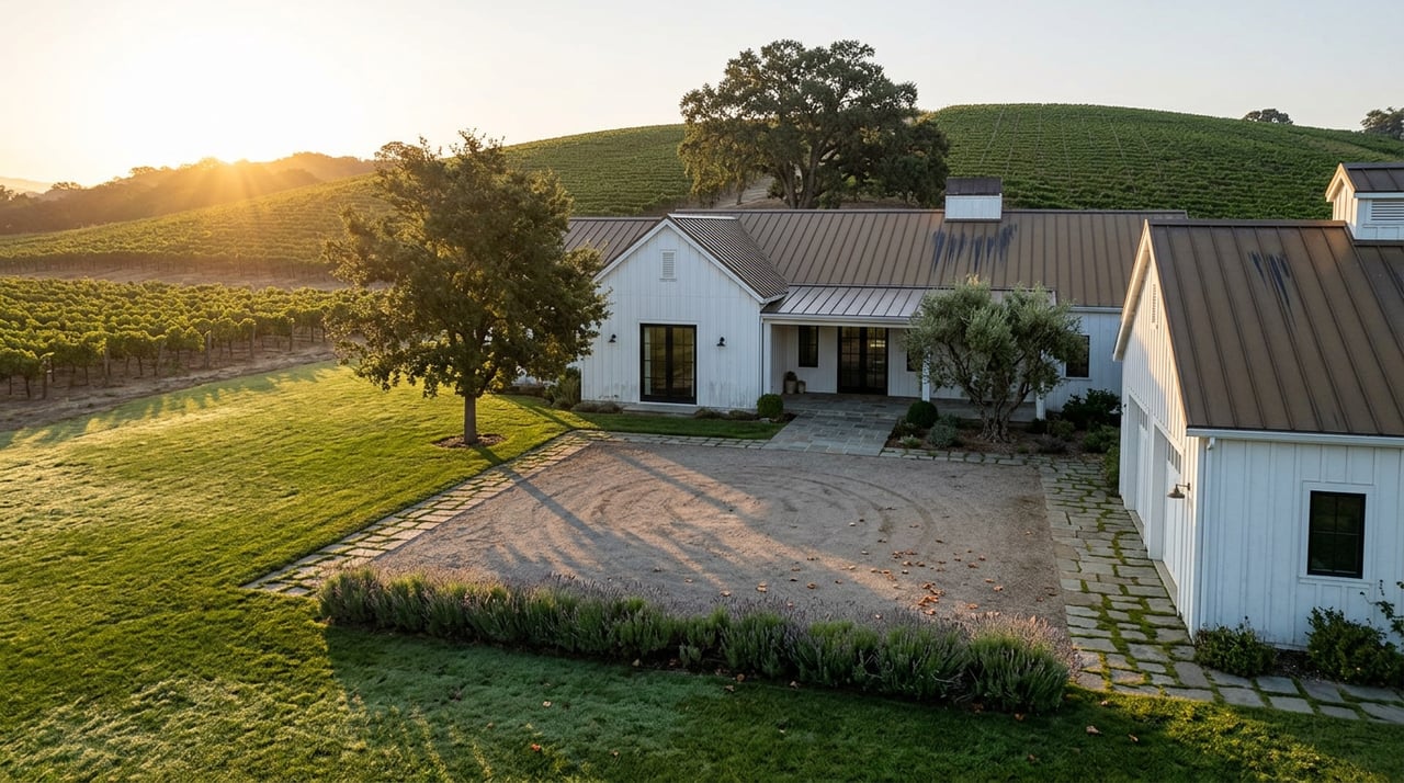
Picture two properties outside St. Helena, priced within a few hundred thousand dollars of each other, both pitched as the kind of rolling, vine-framed parcel that shows up in every wine country daydream. One sits inside the city's water service boundary. The other pulls its water from a private well. Until this year, that difference showed up nowhere on a comparison sheet. Starting this December, it shows up as a line item on a property tax bill, and it will not show up on both.
Napa County's Groundwater Sustainability Agency adopted a new fee on domestic wells and agricultural groundwater use on December 9, 2025, and the Board of Supervisors finalized reduced first-year rates on August 11, 2026. The fee is real, it is billed per parcel, and it applies to some of the exact hillside and valley-floor properties that buyers evaluate against each other when they're weighing a country home near St. Helena against a similar one a few miles up the road. If you're comparing offers on properties like that right now, the fee changes what "comparable" actually means.
Why this fee exists, and why it's arriving now
The Napa Valley Subbasin, the underground aquifer that runs beneath the valley floor from north of Calistoga down past the city of Napa, has been under a state mandate since 2014 to manage itself sustainably or risk having the state step in. California's Sustainable Groundwater Management Act required the county to form a Groundwater Sustainability Agency, which it did in 2019, and to fund the monitoring, reporting, and planning that law requires. For six years, Napa County covered that cost from its general fund and state grants. That approach ran out. The county needed a permanent local funding source, and in December 2025 the Board of Supervisors, acting as the Groundwater Sustainability Agency, voted 3 to 2 to create one.
The fee structure that emerged sorts users into three groups. Agricultural users who irrigate with groundwater were set at a maximum of $98.74 per planted acre, combining a $38.58 base rate with a $60.16 surcharge for groundwater reliance. Growers who dry farm or rely on recycled water pay only the base rate. Public water systems were set at up to $129.87 per acre-foot. Self-supplied residential users, meaning most domestic well owners, were set at a maximum of $62.58 per parcel.
Those were the ceiling rates adopted in December. In August, after reviewing corrected property information and pulling $750,000 from the agency's fund balance, the Board approved first-year fees for fiscal year 2026-27 that come in roughly 55 percent below those maximums. Board Chair Amber Manfree described the tradeoff plainly, saying the reduced fees "allow us to continue implementing the Groundwater Sustainability Plan while recognizing the economic challenges facing many groundwater users." The bills themselves are scheduled to land with property tax installments in December 2026 and April 2027, which means the first real-dollar impact of this policy is a couple of months away, not a future hypothetical.
The part buyers get backward: elevation doesn't mean exemption
Here's where the fee stops behaving the way most people expect. The instinct, especially for a buyer who has spent time on Zillow and Redfin comparing a downtown St. Helena listing to a hillside estate on Spring Mountain or Howell Mountain, is to assume the more remote, more rural property is the one that will owe more in fees, taxes, and hidden carrying costs. For this specific fee, that instinct runs backward.
The Napa Valley Subbasin, as defined by the California Department of Water Resources, is the alluvial aquifer beneath the flat valley floor itself, not the fractured rock formations under the surrounding hills. Napa Valley Register reporting on the fee's approval noted directly that well users in the subbasin, running from Calistoga to south of the city of Napa, are the ones who pay, while those in the Carneros region, the mountains, and other outlying areas are not. A well drilled into hillside bedrock on Spring Mountain or up on Howell Mountain typically sits outside the mapped subbasin entirely, which means it isn't subject to this particular fee no matter how large the parcel or how many gallons per minute the well produces.
Meanwhile, a well-fed property sitting on the valley floor itself, just outside a city's municipal water boundary along a road like Silverado Trail or in the flatter reaches around St. Helena, sits squarely inside the fee's jurisdiction. So does a property inside St. Helena's own service area that happens to rely on a private well rather than the city system, since the exemption is tied to being served by municipal water, not simply to being within city limits.
Here's the maximum fee structure the county adopted before the August rate reduction, for reference:
| User type | Maximum first-year rate (as adopted, pre-reduction) |
|---|---|
| Self-supplied residential (domestic wells) | $62.58 per parcel |
| Agricultural, dry farmed or recycled water | $38.58 per planted acre |
| Agricultural, irrigated with groundwater | $98.74 per planted acre |
| Public water systems | $129.87 per acre-foot |
Actual first-year bills will run about 55 percent below these figures, per the Board's August action, but the relative structure and the boundary rules that determine who pays at all remain the same.
What actually determines liability isn't the listing description
Real estate descriptions for country properties near St. Helena tend to emphasize the well itself. A listing on Spring Mountain Road recently marketed a private well producing roughly 15 gallons per minute alongside a backup spring, framed as a selling point for a self-sufficient hillside estate. A land listing along St. Helena Road highlighted a new private well and a septic design already on file, positioned to speed up permitting for a future buyer. Both are genuinely useful details for evaluating water reliability and development cost. Neither one, on its own, tells you whether that specific parcel sits inside the groundwater subbasin boundary that determines this new fee.
The only way to know for certain is to check the parcel itself. Napa County maintains a public GIS map with a groundwater subbasin layer that shows the boundary directly over an address or Assessor's Parcel Number. A buyer comparing two well-fed properties, or an agent preparing a listing that relies on a well, should treat that boundary check as a standard part of due diligence going forward, the same way a buyer already checks zoning or an existing well's yield.
"These reduced first-year fees allow us to continue implementing the Groundwater Sustainability Plan while recognizing the economic challenges facing many groundwater users." — Amber Manfree, Chair, Napa County Board of Supervisors
What this means before you write an offer
For a buyer evaluating two similarly priced country properties near St. Helena, this fee is now one more real number to put next to property taxes and insurance when comparing total carrying cost, even if the number itself is modest for a single residential parcel. The bigger issue is what it reveals about how differently two nearly identical-looking properties can be treated by policy, simply based on which side of an aquifer boundary they happen to sit on.
For a seller with a well-fed property, particularly one on the valley floor rather than up a hillside, getting ahead of the question matters. A buyer who discovers the fee during escrow, after already anchoring to a number that didn't include it, tends to treat it as a red flag rather than a minor line item. A seller who can hand over the parcel's subbasin status and current fee category up front keeps the conversation where it belongs, on the property itself.
For agricultural or vineyard-adjacent buyers, the stakes are larger. An irrigated planted acre inside the subbasin carries a materially higher fee than a dry-farmed one, which means the county's own fee schedule now creates a modest financial incentive tied directly to how a vineyard is farmed, something worth factoring into any water-rights or grape contract conversation before closing.
A few direct questions
Does this fee apply to homes inside St. Helena's city limits? Generally, no, as long as the property is served by St. Helena's municipal water system. The exemption is based on water service, not city boundaries, so a well inside city limits can still be subject to the fee.
How do I check whether a specific parcel is inside the Napa Valley Subbasin? Napa County's online public GIS map includes a groundwater subbasin boundary layer that can be checked by address or Assessor's Parcel Number, and it's the most reliable way to confirm status before writing an offer.
Will these rates stay this low? The Board used one-time fund balance to cushion the first year specifically. Future adjustments are tied to actual program costs and capped at 4 percent annually based on the Bay Area Consumer Price Index, so the rate that applies this fiscal year isn't guaranteed to hold indefinitely.
Country properties near St. Helena rarely compare as cleanly as their listing sheets suggest, and this fee is a good reminder of why. If you're weighing a hillside estate against a valley-floor parcel, or trying to understand what a specific well and septic setup actually means for your long-term costs, Carolyn Roberts has spent decades sorting through exactly this kind of Napa Valley detail with clients on both sides of the transaction. Let's Connect.